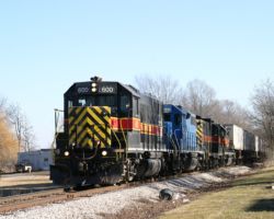
Iowa, Chicago & Eastern on Christmas Eve
The end of the year holidays always mean one thing around here – a trip home to see family and friends. Of course this also means a nice change of railroad scenery and a chance to watch railroads that I normally don’t get the chance to see in action. One of these is obviously my favorite regional, Iowa Interstate. The other is a relative newcomer that I’ve only gotten a brief glimpse of – the new Iowa, Chicago & Eastern, which took over the former I&M Rail Link (IMRL) in July of 2002. Even though I only get to see my family a few times a year, spending 10 days solid with them and my wife’s family might make me a bit crazy and not really relaxed at all. So, I temper it with a bit of railfanning and everybody has a much better time.
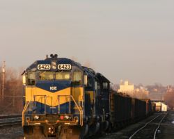
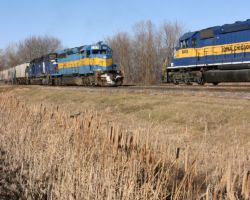
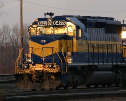
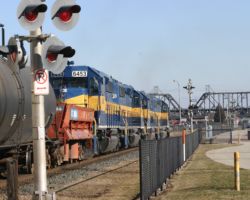
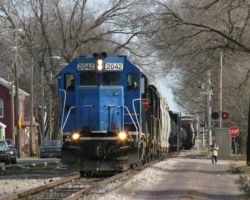
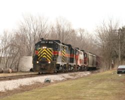
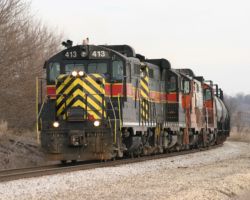
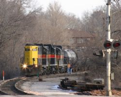
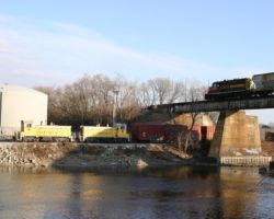
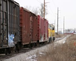
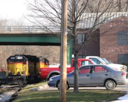
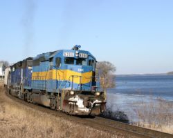
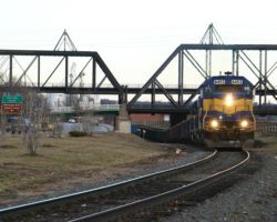
This year, my goal was to spend more time on the Iowa Interstate. Seeing as it runs within half a mile of the houses of both my parents and my wife’s parents, you wouldn’t think that would be all that hard. However, in years past I’ve mainly concentrated on the IMRL for some reason. While I vowed this year would be different, it started out in the late evening hours, checking out what was sitting at Nahant Yard in Davenport – on the IC&E. (Photo #1) However, in this trip report you’ll see three days out with IAIS’s Blue Island-Council Bluffs trains and a morning spent with IAIS’s Milan Local. We’ll just get that IC&E stuff out of the way first, though…
Christmas Eve this year was planned with my in-laws. Since my wife’s family and mine live within 15 minutes of each other, going home is usually an interesting balancing act of splitting time, so we typically rotate (on a yearly basis) Christmas and Christmas Eve. This year, Christmas Eve was with the Thayers, but both my mother and father-in-law had to work for at least part of the day. What to do, what to d… oh wait, go railfanning!
Being that it was the eve of a holiday, I expected that the railroads would be starting to shut things down by mid-afternoon. I’d already received Iowa Interstate’s holiday plans, and there’d be nothing in the afternoon worth going after. Heck, even on a normal day, there’s little to nothing IAIS-related going on in eastern Iowa or western Illinois. I also needed to stay relatively near by, as I figured dinner would be around 1700h or so, and I didn’t want to roll in at the last possible second. So I made the assumption that the Iowa, Chicago & Eastern would be my best bet, and the best place to check on them is their main yard in Davenport – Nahant.
For those unfamiliar with the area, Nahant is a rather large flat yard with an engine service facility, located at the southwest end of Davenport. Public roads provide very good access without ever setting a foot on railroad property. From River Drive in west Davenport, South Concord Street will take you there. It’s the intersection immediately after you cross over the mainline. Otherwise, if you’re coming from the I-280 end, take the Rockingham Road / Hwy 22 exit, go northeast a bit (back towards Davenport), and you’ll see a small road turning off to the right called Wapello Avenue. This will take you right to the turntable and roundhouse. I’ve never had any problems down there, and there’s usually tons of power sitting around to shoot. It’s also a great place to watch for departing trains, if you’re looking for one to follow.
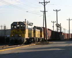
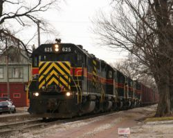
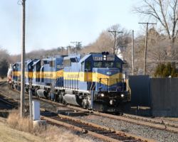
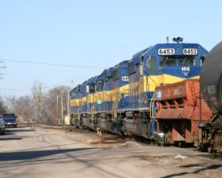
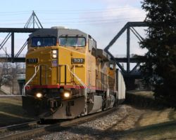
To my surprise, a quick trip to Nahant revealed a northbound readying for departure with a matched set of four IC&E SD40-2s on the front (ICE 6413, 6457, 6443, and 6453). The crew was using them to pull a cut of cars off one of the yard tracks and splice it into the train when I got to the S. Concord Street crossing. A monster of a train, indeed, reminiscent of the IMRL days. The Concord St. crossing had rather horrid lighting (directly backlit), so I headed into downtown Davenport to look for more palatable conditions around the riverfront.
While the Davenport riverfront has been mostly infested by a riverboat casino and its associated private parking lots, there are still a few public parking areas. There’s public parking along bits of Beiderbeck Drive, near Ripley St., I believe. There’s also parking to the east of Perry Street, behind the restaurant by Lock and Dam 15. Heck, just park in the casino lots, I’ve never been bothered (but I don’t stick around long, either), and its the citizens that handed them our once beautiful riverfront in the first place. I have no moral objections to casinos or their ilk, but this one’s just so damned ugly and sprawling in a place that used to be beautiful. Yes, you should be sensing a bit of anger and contempt in my tone, in case you were wondering.
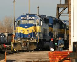
Regardless, being able to park and await the train’s arrival gave me a chance to check on something. Unlike most of the ICE SD40-2s, I got a good look at 6453 beforehand, and it had oddball nose-mounted headlights. Every other one of the rebuilds I’d seen had high-mounted lights, so I was wondering as to the lineage of this unit. Thanks to Joel Kirchner’s excellent IC&E website (as I mentioned in the abstract), a quick check showed that ICE 6453 was none other than BC Rail SD40-2 number 757. It wasn’t until I arrived back in Colorado that I put the pieces together – 757 and the other BCOL SD40-2s used to make ICE 6450-6453 were the same set I saw dead-in-tow on a BNSF manifest in Montana back in May 2003.
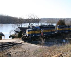
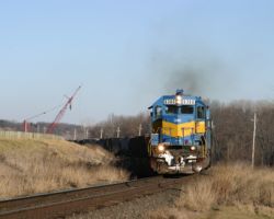
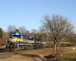
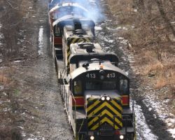
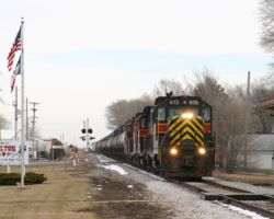
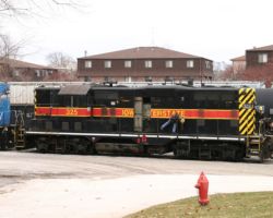
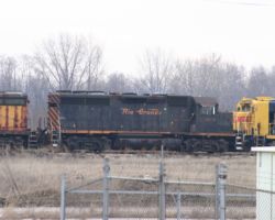
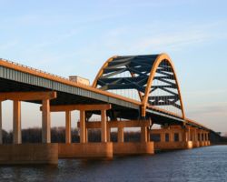
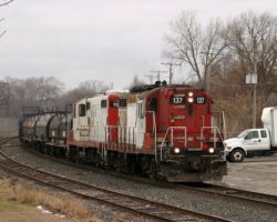
Horns sounding for the crossing down by John O’Donnell (the local baseball stadium) snapped me out of my temporary BCOL fixation. After years of trying to move the former Milwaukee main off the riverfront (under the guise of it being an eyesore, dangerous to already oblivious and trespassing individuals, etc.), the city and developers finally conceded and just fenced the sucker. Good for the railroad, bad for the photographer. Anything other than a long telephoto shot tends to get a lot of chain link fence in it. So, a long telephoto shot it’ll be of ICE 6413 leading across one of the half dozen or so grade crossings in the downtown area. (Photo #2) The bridge in the background is the Davenport side of the Centennial Bridge – the big multi-arched one you see in many shots of the QC area.
Since I was caught on the wrong (river, rather than highway) side of this manifest due to light reasons, I had to wait through the whole darn thing before I could actually head off towards the next shot. It gave me a moment to sit and contemplate the next shot, which I’d tentatively planned as somewhere near the waterworks in east Davenport. However, after finally crossing the tracks (having to wait for all of the gamblers stuck behind it as well before I could even pull out) and then getting stabbed by a couple of red lights on River Drive, it was quickly becoming apparent that the waterworks wasn’t going to, well, work. The next shot I knew how to put together in a hurry was at the Bettendorf floodwall.
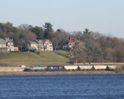
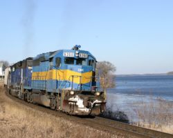
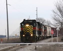
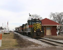
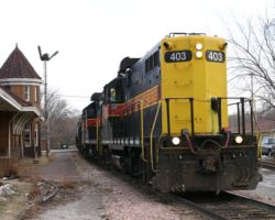
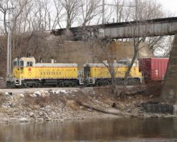
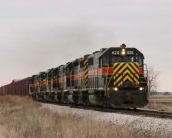
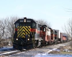
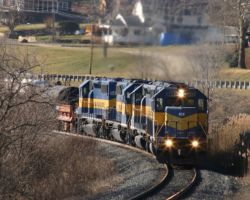
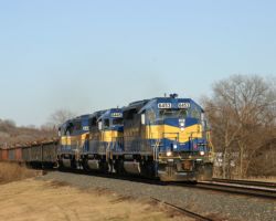
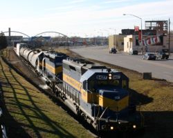
Located just to the east of the I-74 bridge in Bettendorf and accessed by 12th Street, there’s a great little park down at the riverfront near the south end of the siding. Being a public park, it’s a good place to sit and watch the action without getting hassled. The park itself sits up on an embankment (part of the flood wall), giving a nice perspective looking down on the main and siding below. At the west end of the park (railroad south) is the south switch and the floodwall gate. The gate is a large steel barrier dropped in whenever the old Mississippi starts crawling over its banks to prevent water from outside Bettendorf (which does not have a flood wall) into the downtown. It does sever the railway, but by the point they use it, the mainline through Davenport is already under water. Our train, the 6413 north, pulled up to the switch and passed right on through. (Photo #3) With their slowing, I suspected that they might be in for a meet, but no such luck. They were just checking the the switch was lined appropriately, I’m guessing.
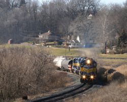
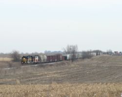
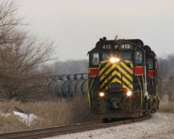
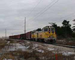
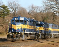
From there, I’d hoped to grab another shot somewhere up by Alcoa, but the crew (probably anxious to go home for the holidays, but I don’t know) was taking full advantage of the good track speeds through Bettendorf, and I, once again, had to wait for the entire train to pass before departing. I wasn’t even up to the tail end by Alcoa, let alone far enough ahead to put together a shot. North of Alcoa lies Pleasant Valley, and north of there I knew of a sweeping curve in the line right alongside US 67 north. The highway was recently widened to four lanes here, and with many people used to parking alongside the road to walk to their riverside cabins below, no parking signs have sprouted everywhere. I found a spot, though, where I could both get safely away from the highway and be far enough (probably an eighth of a mile or more) from a no parking sign to have plausible deniability if the law decided to ask questions. In a few minutes, I had yet another one of those shots I’d always thought about actually safely captured in the camera. (Photo #4) Also, a second or two later, ICE 6413 passes right below me and in front of one of those small riverfront houses I’d mentioned. (Photo #5)
Ah, the joys of being on the right side of the train when you get done with the shot. Within a minute, I was back on the road and even with the lead unit again. Still, Le Claire is where the Mississippi River changes from flowing north-south, as it does for most of its journey, to flowing east-west as it does through the Quad Cities. This means that the railroad and the highway also swing to the north, putting some severe backlighting on most possible shots. Still, Le Claire is a neat old river town not to be missed, as it, too, has near street running. The ex-Milwaukee runs down streets or nearly down streets in many of these river towns due to the limited space between the bluffs and the river below. In Le Claire, it runs down the side of a back alley behind the main street. It’s also the first siding out of the QC area, and seems to see a lot of use for meets (or at least it did while I was around – I’m not that familiar with IC&E operating patterns). 6413 made the necessary speed adjustment for town, but made no sign of taking the hole for a meet. (Photo #6) I didn’t really expect one, considering a holiday was quickly bearing down on us and traffic should be lightening up, but there’s always wishful thinking.
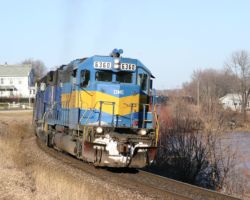
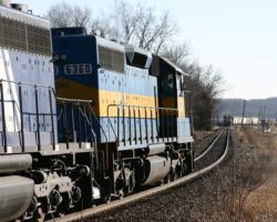
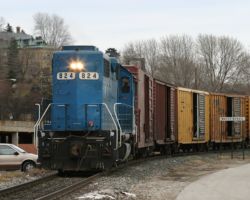
I pulled off to the side of US 67 north of Le Claire to get a shot if 6413 north with the town in the background. As I was pulling over, I was looking behind me, and I could see headlights barely peaking out this end of town. What I didn’t notice was what was in front of me – Dakota, Minnesota & Eastern 6360 leading a southbound. It wasn’t until I looked up after shutting the truck down that I noticed a big blue diesel looking back at me. There was a meet, and I’d almost missed it! (Photo #7, 8, 9)
I’d planned to turn around at Le Claire anyway, but now I had a legitimate reason – another train to follow. I just couldn’t find a spot on the big curve from before that I liked again, so I set up at the grade crossing just down from there (the road the leads to Lock and Dam 14, one up from Davenport). It took what seemed like a small eternity, partially because the meet was a saw-by. Based on what I saw passing back through town, 6413 was holding the main because it was too darn long to fit in the siding. Presumably, 6360 south took the hole, waited for 6413 to pull through and clear the switch, and then let itself out the other end. Still, I like the resulting image (Photo #10) – typical warm late afternoon light in the Midwest, one of those things I really miss out here where the mountains cut off the light about 30-60 minutes before sundown.
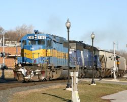
Lying at the boundary between Davenport and Bettendorf is a bit of a wide spot in the river. At this point, there’s a large curve at what’s known as the Village of East Davenport (now just part of the city proper), near the Davenport water works. This is also where the Eldridge branch splits off and heads up the hill. Easily accessed by a bit of Bridge Ave. that crosses the tracks down to a restaurant, it’s a nice public spot. From here, you can see across the wide spot to the line passing below the massive old homes of lower Bettendorf (Photo #11). A few minutes later, the train emerges right in front of you as it follows the river down through Davenport. There’s a walking/biking trail along here that makes for a great way to set up close shots while remaining safely out of the way. (Photo #12)
After getting that last shot, I decided to call it a day. The light was failing, and I only had an hour or so until dinner. So I packed it in and headed up the hill for Christmas Eve. Coming up in Chapter 2 – other bits of the IC&E that came from the rest of the trip. While I didn’t ever follow any other IC&E road trains, I did check by Nahant and other parts of the IC&E in the area quite a bit to see what was going on and get roster shots of as many units as possible.

More Assorted IC&E – Dec 19-31, 2003
Obviously with a week in and around the Quad Cities, I was going to run into IC&E a few more times. None really warranted any narrative, nor were a real sequence of events. So I’ve just lumped them all into an assorted album.
Iowa Interstate’s Milan Branch
One of Iowa Interstate’s few remaining branches is the little-noticed Milan Branch operation. With the Audubon Branch dismantled, the Hancock Branch amounting to little more than a large storage track, and the Pella Line steadily being clipped back towards the mainline junction at Altoona, most of IAIS’s branch operations have ceased. The exception to this is a rather short stretch extending south and west from the Rock Island yard, serving several industries in Rock Island and Milan, IL.
The branch started life as the Rock Island and Mercer County Railroad Company in 1876, and track was completed as far as Sherrard. The purpose of this line, in addition to helping open up markets for agricultural products in Mercer County, was really built to tap the coal deposits around Cable, IL. The line went south from Rock Island to Milan, then turned west and then south to run through Taylor Ridge and Reynolds. At Preemption, the original line apparently went to the mines at Cable in the 1876 timeframe. A year later, the little railroad became part of the Rock Island & Peoria Railway, the latter already having a line from Rock Island to Peoria (per a 1898 Rand, McNally & Co. map). (For reference, the RI&P main diverged at Milan, proceeding through Coal Valley, Orion, Osco, Cambridge, Galva, Wyoming, and Prince.) While the line was under the control of the Rock Island & Peoria, the Preemption Eastern Railroad built a line from a connection at Preemption to the coal mines at Sherrard in 1894. Both of these little railroads eventually succumbed and, a decade and a half later, on 11-Jun-1903, were sold to the Chicago, Rock Island & Pacific.
The Rock Island then turned around in 1905 and leased the Rock Island to Cable/Sherrard lines to the Rock Island Southern. The RIS was a newly formed interurban company that had recently acquired the former Western Illinois Traction line from Monmouth to Galesburg. With the lease, the RIS began putting together a line from Monmouth up to Rock Island. In 1910, the road completed the new trackage, probably joining at what I believe was called Southern Junction, about halfway between Reynolds and Matherville. This new line was electrified with AC power, making it incompatible with the road’s previous 600V DC Galesburg line. This northern extension, roughly 50 miles in length, only was under wire for about eight years. Electric operations on the Monmouth-QC line ceased sometime near the end of World War I, being replaced by a pair of steam locomotives. Gradually, as traffic declined and the line fell in to disrepair, it was cut back starting from the Monmouth end. In February 1952, operations on the RIS ceased entirely, and most of the line was torn up.
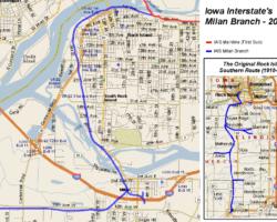
However, at least part survived as part of the Rock Island. I’m not sure how much of the CRI&P section survived, but as of today, the former RIS main is intact out to just out past 92nd Avenue West in Rock Island, a distance of about 3.5 miles from the Milan Junction or ~8 miles from the Rock Island yard. In addition, what I assume is the former Rock Island & Peoria main survives for a mile or so, branching from the line at the Milan depot and heading east to serve a few small industries. With the fall of the Rock in the early 1980s, the line was eventually sold, along with the Rock’s Chicago-Omaha mainline, to Iowa Interstate, who today continues to provide service. A map showing both today’s branch and a rough approximation of where the original Rock Island Southern mainline ran are included as Photo #27.
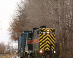
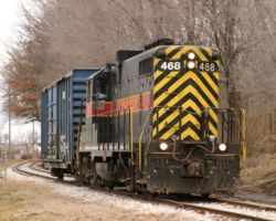
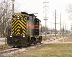
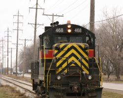
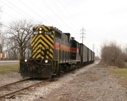
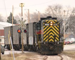
The Milan Branch today receives service via IAIS’s RISW, the Rock Island Switcher. This is the local RI job, and it seems to typically go on duty at RI around 1000h. Since I’ve never gotten the opportunity to photograph this train in action, I made it one of my top goals while home in the Quad Cities. On Tuesday, 23-Dec-2003, I happened to be over at the Rock Island yards at just the right time to see the local, headed by IAIS 468, head out along the line at about 1100h. Despite having decent lighting in the early morning, noon and the afternoon weren’t looking so good, with grey cloud cover and light snow from time to time. Still, I had the train and I had the time, so I figured it was as good of a day to chase the local as any.
The first mile or so of the branch (from where the former Omaha main splits to cross the Mississippi) is shared with BNSF and the Iowa, Chicago, &Eastern. These two roads cross over the river via the Crescent Bridge and use joint trackage with IAIS up through Rock Island and Moline. I believe BNSF mainly uses it to connect the Clinton local job to its yard at Barstow, and the IC&E uses it to service the former Milwaukee/Soo line up the east side of the Mississippi, through East Moline, Hampton, and Port Byron. At the south end of the Crescent Bridge, however, the Milan Branch breaks off, and it’s pure IAIS all the way to the end.
Since on this trip I had a particular knack for getting tied up in traffic, I missed the first few opportunities to photograph the local. Missed it downtown RI, and then missed it again as it crosses 3rd Avenue just past the bridge junction. I’ll be honest, I didn’t know where the local had gone at first. I half suspected that it had crossed the river to handle the IC&E interchange at the old Missouri Division Junction, just east of Division St. in downtown Davenport. So, I headed across the Centennial Bridge, only to see the beacon on IAIS 468 blinking in the distance. Oops, bad choice on my part.
For those unfamiliar with the area, 11th Street is the fastest (and just about only) way down from Rock Island to Milan. It follows the branch fairly closely, but definitely not closely enough to see anything as the separation is usually several blocks. However, since the entire branch is FRA Excepted Track (and thus has a very low speed limit), 11th Street provides a nice way to get ahead of the train. The whole drive down from RI, I was thinking about one of the shots I’ve always wanted – the train crossing the old bridge over the Rock River, right beside the hydro plant. However, I figured with the low speeds, I’d have plenty of time for a couple shots. So, I set up at the first grade crossing I could find – 42nd Avenue.
As I looked back up the line towards RI, I could see 468 and crew switching some industry. Not being smart enough to bring a scanner on this trip (yes, I’m an idiot, I know), I just decided to patiently wait and watch the lights. While waiting, I noticed a couple concrete blocks somebody had dropped in the gauge on the far side of the crossing, and decided to go move them just to be helpful. I figure a locomotive would probably deflect them without issue, but I didn’t particularly want one deflected into me. Within short order, the vast majority of the train (100 ton center flows, I think) had been dropped at the mystery industry in question, and they were on their way south again. Total train: one single boxcar. Tuesday wasn’t looking like a good day for railfanning the Milan local, since I wanted to see them actually go out to the end of the line. Realistically, with one boxcar, what were the chances they’d actually do that? I grabbed a few shots (Photo #28, 29) and headed on down to set up for the bridge shot I’d been wanting.
The bridge over the Rock River is a two part creature, with a small island in the middle of the river. The first set of spans runs parallel to the Hwy 67 bridge between Rock Island and Milan, as well as to the old Sears Power Dam. The dam, currently back in use as a hydroelectric generating facility, was actually built in 1838, and later converted to produce electricity (instead of direct mechanical power to Sears’ mill) in 1912. It’s been noted in several things I’ve read over the years that it produced power for the Tri-Cities Railway & Light company (the local Quad Cities interurban line), so it may very well have produced power for the Rock Island Southern as well. I just don’t know. The Argus/Dispatch ran a short piece on the Sears Dam back in 2001. The Illinois Trails website has republished it in four parts – #1, #2, #3, and #4.
Okay, back to the present day. From a railfan perspective, this small island in the middle has a single street that crosses the line – North Street. From this crossing, it’s possible to get a decent shot of the train passing through the bridge. Also, assuming you’re good on the lights back from the 42nd Avenue crossing, making both shots is absolutely not a problem. (Photo #30)
Past the island, the line crosses another similar set of spans and then drops right into downtown Milan. Near the junction of 4th Avenue and 4th Street in Milan, the old depot sits right between the east and west leg of the wye. I believe the west leg is the old RIS mainline south towards Monmouth, while the east leg was the old Rock Island & Peoria main to Peoria. Today, neither lives up to these grand histories. The east leg goes less than a mile, crossing under I-280 to the former Eagle Foods supermarket warehouse, and also branching off to serve a lumber yard. The ex-RIS west leg is now the longest, continuing out about three miles to end out along Illinois 92 west of town.
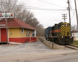
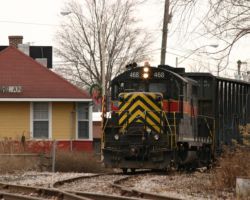
Without any idea which way the local would be heading (and with only one boxcar, I figured I’d better pick the right one), I pulled off in the old depot parking lot and spent the few seconds I had figuring out photographic options to go either way. As things would turn out, the crew brought 468 up to the switch and headed on down the east leg. My hopes for actually catching one out on what I’ve always considered to be the Milan line were sinking (the west leg, the branch along Milan’s 10th Ave West), but at least I’d have the depot shot. (Photo #31)
With 468 and car disappearing back into the industries on the east leg, I headed off for some lunch. While there are a great number of excellent choices for food in the area, I decided to stick close to the line and just grab food at the Burger King on 1st Street. The obvious side benefit of this particular affront to the culinary arts is that, in the event the crew headed back to Rock Island while I was eating, I’d see them and could take appropriate actions. Sure enough, halfway through my sandwich, 468 came pulling across 1st Street with a small cut of empty center-beam flats. Back over to the wye…
The crew stopped 468 and train clear of the switch, threw it, and headed up into the siding that exists on the west leg. Sure, that made sense – they were doing a run-around so that 468 would be in the lead going back. What surprised me was when they dumped the cars on the mainline and took off with the motive power. I was pretty sure that the siding ended before the I-280 underpass, but off in the distance I could see 468’s flashing beacon disappear under the bridge. I waited a minute, and then quickly figured out that while there wasn’t anything to drop off further down the branch, there might just be something to pick up. With 468 already having a sizable lead, here’s where you’ve got to be thankful for low branchline speeds.
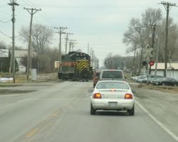
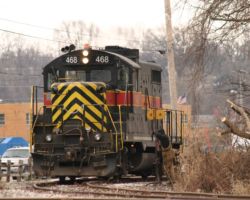
Turns out that finding ol’ 468 wasn’t hard at all. As I headed down 10th Avenue out of town towards the branch, the grade crossing lights flipped on, and one IAIS GP10 came trundling across the highway. (Photo #32) Now, for another irrelevant tangent: It’s truly amazing how irate some drivers get. One little diesel crossing the highway and the woman in front of me was flailing her arms about like she’d been delayed for hours. And I thought all the caffeine made me twitchy some days…
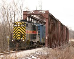
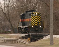
The branch roughly parallels 10th Ave as it runs out of town towards the junction with Illinois 92. There are various industries scattered along the line, most of which I can’t recall at the moment. There were several tank cars in one siding, but 468 passed on by without even stopping (Photo #33). Trundling west, I kept looking for a shot near whatever industry the crew was out here to service, but 468 just kept going. (Photo #34) Thinking nothing of it, I set up a shot of the unit crossing a low wooden trestle (Photo #35). Just when I thought I might really luck out and it would be going to whatever industry lived out at the end of the line, 468 ground to a halt immediately in front of me, just beyond the 29th Street crossing.
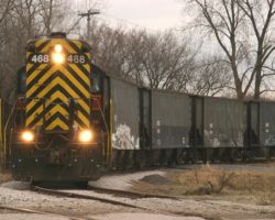
What I didn’t realize was that one the other side of the track, a spur dropped away from the grade rather quickly to duck behind the industries on the east side of 29th Street. I hadn’t even seen it from my vantage below grade level. Before I could get across the highway, 468 and crew had rolled back in behind the industries along 29th. In a few minutes, they returned with four SIEX cars (Photo #36), which are used to carry volcanic scoria. Volcanic scoria is a reddish lava rock, and the SIEX cars loaded with it come from none other than Antonito, CO, on the ex-Rio Grande San Luis Valley lines. These were empties, so they’d probably be returning to Council Bluffs to be interchanged with the UP, who would then interchange them with the new San Luis Rio Grande that now runs the SLV lines. I’d heard these mentioned before on the IAIS list; finally, I knew where they actually went – a bulk landscaping material company in Milan.
From there, apparently there wasn’t any further work to be done. They pulled up off the spur, and one of the crew closed the switch and jumped on the front car to protect the move back to a point where they could get 468 back on the front. With that, they were headed back down the branch to pick up the other empties that they’d left behind by the depot. (Photo #37, 38)
With the cars out in front of the locomotive, the switching back near the depot was as simple as tacking the four scoria hoppers onto the back of the empty centerbeams from earlier, and then running around the whole mess, backing onto the whole cut, and dragging it the three miles back to the Rock Island yard. It happened just as expected – cars onto the back, 468 runs around, the guy on the ground opens the switch (Photo #39), and… well, the last stage didn’t happen as I’d expected. 468 pulled forward a few feet, and then the air dumped, the brakes went on, and the crew departed to grab a little lunch (Photo #40). It was just as well – I had another meeting (with an ex-Rock Island signal maintainer that’s a friend of my father) in Davenport and needed to get going. Not a bad day with the RISW out on the Milan branch.
Iowa Interstate’s BICB-24 with Four Paducahs
The day after Christmas, I didn’t actually roll out of bed until around 1000h. I’d been down celebrating with family and friends in Peoria the night before, and hadn’t gotten to bed until well after midnight. I finally stumbled towards the window and looked outside to find some very nice, crisp blue skies, and suddenly the enthusiasm level went up a bit. A quick check of the email revealed nothing on the Iowa Interstate list that indicated what was operating, so I trudged off to the shower to warm up my brain with a little hot water. At this point in the trip, I still hadn’t gotten used to the schedule of Iowa Interstate enough to have an idea where things would be that time of day. Even if I did, it was the day after a holiday – there was no telling how that would affect it.
Many of you already know that I’m an Iowa Interstate fan, and have been for years. Back in 1996, Michael Petersen and I put together the Unofficial Iowa Interstate Photo Archive and Railfan’s Guide, which we continue to maintain (sporadically) to this day. For fans, the Iowa Interstate list is an absolutely invaluable source of fanning information and daily on-topic banter, with both employees (in an unofficial capacity) and fans participating regularly. It’s an interesting regional that runs all first and second generation EMD motive power (aside from the three M420Ws), and everyone seems to be very friendly to responsible fans. It’s a refreshing change from the fast-paced, sometimes hostile environment that surrounds the Class I roads these days.
After throwing on some clothes and being coerced into breakfast by my mother-in-law, I thought to check my mail one more time. Sure enough, as the last message sat an interesting little tidbit from Allan Hunt: BICB 24 is called for 1030 at Rock Island, with engs 413, 484, 481 and 466. For those unfamiliar with IAIS operations, the IAIS’s two mainstay trains are BICB (Blue Island, IL – Council Bluffs, IA) and CBBI (Council Bluffs to Blue Island). They’re often referred to as the west and east trains, respectively, due to the fact they’re the main road freights that run end-to-end on the line. BICB-24 was called out of Blue Island, IL, on Christmas Eve, but held over the holiday at Rock Island.
Because it was now already pushing 1050h, I figured a 1030h called train would already be picking its way through Davenport. My in-laws live only 6-7 blocks from the West Central Park grade crossing in Davenport, and as such locomotive horns stand out readily. Not only that, but any train fighting its way up Davenport Hill (the grade out of the river bottoms) makes a heck of a lot of noise. Since I’d heard neither, I could only conclude that it had either gone by while I was in the shower (unlikely, not enough time) or would be there shortly. I jumped in the truck and headed down the hill along the line using Cedar Street south of Locust. It follows the route closely enough to keep an eye on it, since I often have had trains give me the slip through this section.
Backtracking towards the Government Bridge (and thus the river crossing towards Rock Island), I still saw a great deal of nothing. Somewhat unnerved, I called my father out in Walcott to see if anything had gone by. No sooner had I gotten him on the phone than I looked over and up Brady Street just in time to see 413 pulling over the bridge. Through downtown Davenport, IAIS runs over a low elevated platform (including the infamous Brady and Harrison bridges, known for their tractor-trailer eating abilities), and then drops to almost street running as it picks its way through the west end of downtown. A narrow one lane brick street runs on each side, and in the middle where there used to be the Rock’s dual tracks, today there is only the one. It’s not BICB-24, but I’ve included BICB-26 from 27-Dec-2003 as Photo #41 to give you some idea of these cramped quarters. This section is between approximately Gaines St. on the east and Taylor Street on the west. To the west of the street running is the former Missouri Division Junction. This is where the Rock’s mainline split into the Golden State route (now the Iowa, Chicago, and Eastern), which split off for New Mexico, and the Colorado mainline (now the IAIS), which headed west across Iowa, Nebraska, and Kansas. The ex-Colorado main heads up out of the river bottoms at this point, hence starting the formidable climb known as Davenport Hill.
Next history lesson: The ex-Rock ex-Colorado mainline across Iowa. The line was originally built by the Mississippi and Missouri Railroad Company, chartered to build across Iowa between its two namesake rivers, linking Davenport to Council Bluffs. Construction started in June of 1855, and continued fevorishly to Iowa City (then Iowa’s capitol) in order to obtain some sort of bonus for completing the line within a prescribed interval (by 1-Jan-1856). From there, the line proceeded westward at a leasurely pace, only reaching approximately Newton before the Rock Island bought them up in late 1866. The Rock Island then went about finishing the line to Council Bluffs and, eventually, a junction with the Rio Grande and ATSF in Colorado Springs, CO.
I knew by the time I got turned around, there wouldn’t be enough time to set up a shot in the street running section, so I headed about halfway up Davenport Hill to the Brady Street overpass. At this point, the train is fully working against the grade, and it can put on a very loud, smokey show as the crew fights the tonnage up the hill. It’s also very nicely wooded, providing a very nice shot. It’s also one of those angles I’ve seen since I was a kid, and never got the chance to shoot. Today was to be the day, as a solid set of 4 first generation Paducah rebuilds barked under the bridge (Photo #42).
The next stop was a curve just east of Walcott (and just east of the new east siding switch). A few years back, the siding originally constructed from the Rock’s second main through Walcott proper was replaced with a new one built east of town. This new 6520-ft. siding is often used to tie trains down, due to its relatively good length and complete lack of grade crossings. There’s a gravel road that runs roughly parallel to the line, now called 190th Street or some such (West 60th St. once you get in Davenport). It’s also known as Probstei Road locally. While a westbound train doesn’t make the best subject at high noon, the shot didn’t come off too badly after a bit of cropping to fix the composition.
By using 190th through Walcott (called Memorial Road), and then continuing west once it turns back to gravel, it’s possible to keep up with a westbound without much speeding. This is especially true, since I stayed on the south side of the track at the grade crossing, saving me from having to wait through the whole train before departure.
The next town you’ll come to on the line is Stockton, IA. Stockton is a former crossing between the Rock Island and the Burlington, Cedar Rapids, & Northern mainlines from Davenport to Iowa City. What I believe was a predecessor to the the BCR&N passed over the Rock on a short bridge, whose abutments are still visible today around the corner to the west of Stockton’s only grade crossing. Other than a short, crumbling stretch of track in West Davenport, some abutments in the West Lake dam, and a short wooded stretch south of Walcott, this is one of the only remnants of the line left in the area. Presumably it was abandoned (I believe in 1943) in connection the Rock’s acquisition of the BCR&N and the route’s duplication of the Rock’s more direct Davenport-IC mainline. Today, the only railroad in town is Iowa Interstate. For some reason, BICB-24 slowed east of town, and thus I was able to catch it both coming through the rolling farm fields (Photo #44) as well as bursting out of the trees and through town (Photo #45).
From there, I had to wait for the train to clear, since old US 6 (now Hwy 927) north of Stockton is the best way to pursue Iowa Interstate to the west. That put me a considerable way back, since BICB-24 was no lean, mean manifest – rather more a long, trundling wayfreight that happened to be keeping the track speed of 40 rather well in most spots. By the west side of Durant, though, I already had a few second lead, but due to lighting and a particular scene in mind, I decided to continue to Wilton rather than stop for any of a few dull grade crossing shots beforehand.
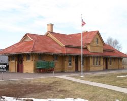
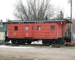
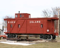
Wilton, being another old junction town with a decent Iowa sense of history, has a nicely preserved depot and an old Rock Island caboose to go with it, in addition to a train order semaphore. (Photo #46 – CRIP 17087, supposedly. It doesn’t look much like its siblings in the 1708x series with those ribs down the side, though, so I suspect it might be somebody else’s caboose underneath.) Wilton was the junction between the Mississippi & Missouri’s east-west mainline between Davenport-Iowa City (after 1866 the Rock Island main) and the M&M’s branch line from Wilton down to the river town of Muscatine. The old branch wyed off to the south of the depot, with the depot itself sitting in between the mainline and the east leg of the wye.
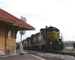
I’ve always wanted to catch an Iowa Interstate there by Wilton’s depot, but never really managed to do it before. So, I grabbed something to eat and drink and the local convenience store, and then settled in by the crossing to prepare for the oncoming train. And I waited, and waited… and waited… and waited… Finally, about 30 minutes later, 413’s nose lights finally were peeking over the horizon. As they came a bit closer, the answer to their disappearance was apparent – the crew had stopped at the siding west of Durant to pick up the string of ADM tankers that was in storage there. On the front of the train were 25 or so tank cars that weren’t there the last time I saw the train. I caught a few shots as he passed the depot, and I feel the need to include two of them – one of IAIS 413, the US and Iowa flags, and the Wilton sign that reminds us that we’re On the Right Track (Photo #47), as well as one actually showing the train, the semaphore, and the Wilton depot. (Photo #48)
From Wilton
Continuing west from Atalissa (having failed to beat 413 to the grade crossing on US 6 and then waiting for the whole thing to pass), I quickly overtook BICB again due to it slowing significantly just outside West Liberty. As you might have guessed based on how this trip has gone so far, West Liberty is yet another railroad junction town, and there’s always a few nuggets of history to go with it.
West Liberty marked a grade-level crossing with another BCR&N mainline – this one running northwest from West Liberty up to Cedar Rapids and eventually Manly, IA, where it joined the RI’s Twin Cities – Kansas City mainline. This was the western end of the double track mainline from Chicago, as well, since a significant amount of traffic went north as well as west in the Rock days. From here west, the Colorado line was single track. Today, the West Liberty-Cedar Rapids line is torn up, but parts of the Manly to Cedar Rapids section remain as the Iowa Northern Railway. South of West Liberty, the line connected southwards to the Golden State route at Columbus Junction and then further south to Burlington. Nothing, to my knowledge, remains of this section of the line today. However, not all railway notables in West Liberty is in the past. Iowa Interstate has opened up an intermodal facility for eastern Iowa just west of town, and it seems to do a reasonable business.
The depot has been recently restored (Photo #50) to excellent condition, following years of neglect after the fall of the Rock (broken windows, missing roof tiles, general decay). It’s now a museum, apparently open Monday-Friday during normal business hours, and 9-12 on Saturday. I can’t vouch for that, as I never saw it open when I was there, including mid-afternoon on a Tuesday. However, the holidays are strange, and there may not have been enough volunteers to do so for normal hours. Also, beside the station is another Rock Island caboose (Photo #51) – this one a wood-sider but bearing no apparent number. In front of the caboose is a track diamond, presumably the crossing of the two mainlines cut out of the track when the BCR&N was removed. On the diamond sits a two-axled trailer for a maintenance-of-way speeder. Very nicely done, especially considering what I remember it looking like only a few years back. Of course, the depot definitely looks better with a train (Photo #52) passing in front of it. A Rock Island would be better, but IAIS isn’t bad.
West of West Liberty, the line dips away from US 6 for nearly the entire distance into Iowa City. The only town (and one of the few points of access) in this segment is Downey, a small farming community roughly 4-5 miles west of West Liberty. It can be accessed by using US 6 west to X30 north, but following BICB-24 I chose to head on in to Iowa City and wait there instead. The skies to the west were looking more promising, with a hint of sunlight burning through the cloud layer. There’s a photo of Downey later on in the trip report for those interested, from following BICB-29 instead.
Iowa Interstate’s main facilities in Iowa City are located just to the west of Dodge Street. Here you’ll find their yard operations, engine house, and a small, two story brick building that houses their dispatching and operations staff. There are two overpasses – Dodge and Summit Streets. Summit Street, up near the east yard throat, provides a few handy benches for railfans directly above the tracks, but unfortunately is decently far away from the usual action. It also has very little street-side parking nearby, making it a bit of a walk from wherever you find to drop your car. Dodge Street, on the other hand, is on top of the yard, giving you a good view of operations, even if they’re taking place at the west end. There’s easy parking nearby, with a small city park right behind the office building.
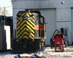
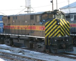
I decided the best shot for the day was from Dodge Street, just because I didn’t want to figure out where to park on Summit. When I arrived, a unit with a low nose headlight and striped ends was switching the far west end of the yard. Within a minute or two, it disappeared with a single car or so. I wasn’t exactly watching it closely, so it actually slipped out of view while I wasn’t paying attention. I assumed they’d either tied the unit up at the west end of the engine house, or taken it down the Hill track for some reason. I waited for about another ten minutes, and finally got BICB-24 pulling in to the east end of the yard. (Photo #53). On the assumption that it was going to be a relatively quick car drop and crew change, I then took off west to sit at the old Rock Island depot west of the yard.
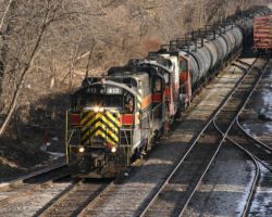
A quick crew change wasn’t what was in order for BICB. Instead, the power cut off, and another crew brought some other idling yard power up to begin tearing apart the train. Included in this yard consist were 403 (the last all-yellow nose unit), 400, and 468. First to come off were the ADM tankers that were picked up at Durant. The nice thing about this is that there are a number of grade crossings on the west end of the yard, near the old Rock Island depot. The depot itself is now privately-owned office space, but on weekends I’ve never had any problem sitting in the parking lot watching trains for a while. Plus you’ll see great views of trains passing the classic old Rock bay window and train order signal. (Photo #55) Even with the up-close and personal look a the yard switcher, though, I eventually decided to move on to better prospects.
The CRANDIC – Dec 26, 2003
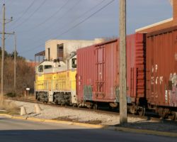
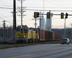
Initially, better prospects meant determining to where 402 slipped away. However, upon reaching the west side of the Iowa River, I noticed a bit of movement – not on the bridge, but below it. While the bridge itself is obviously Iowa Interstate, the tracks below belong to a small Iowa shortline known as the Cedar Rapids & Iowa City – or CRANDIC for short. The road started out originally as an electrified interurban between Cedar Rapids and downtown Iowa City. Discontinuing electrified passenger service by 1953, they slowly evolved into a freight carrier. In addition to their original mainline (the one here under the IC bridge, running north to CR), somewhere along the way they acquired the former Milwaukee from Cedar Rapids down to the Amanas, connecting with Iowa Interstate again at a location called Yocum Connection. Today, they operate a small fleet of first and second generation power over these routes, and in addition own (or at least used to own) part of Iowa Interstate. Iowa Interstate, in turn, provides them with connections to roads other than Union Pacific. For those interested, their website has an excellent short history of the line, much more complete than my brief version.
On this particular Friday, CIC 107 and 110 (a pair of SW14 units) were switching away at on the track under the Iowa Interstate bridge. This line, while it technically connects to the IAIS yard via a switchback and some very tight street running, is not commonly used for interchange. The Yocum Connection route is the preferred method of interchage with IAIS. Most of the traffic the CIC deals with here in IC is local to their spurs and sidings. Never having seen the CIC on the Iowa City line before, I decided that it would almost be more interesting than IAIS for the rest of the afternoon. Amazingly enough, I even had bright sunlight for the first time since the morning. I sat in the old Dairy Queen lot on the north side of the river bridge, watching the CIC crew move cars about for about half an hour. At least twice, people pulled up, asked if I was watching the eagles, and then look confused when I told them I was really out watching the trains. Don’t get me wrong, bald eagles are a lot of fun to watch, but I was there mainly to shoot trains. We’ll leave the birds to my wife.
From time to time, the IAIS yard switching job would pull far enough west to be see on the bridge as well (Photo #56). Other than that, the CIC train would be beyond view for a few minutes at a time, and the monotonous back-and-forth was starting to lose my interest. Just about 1500h, as I was considering calling it a day, I heard a rumbling overhead and looked up just in time to see 402 returning east. The Wilton local crew had apparently taken it somewhere west of the yard (probably out near Coralville, I’d guess) to retrieve a cut of cars. I was a bit disappointed I hadn’t gone after it, but then again I’d never actually gotten the chance to watch the CIC in action, either.
Without a scanner, I just had to make my best guess based on experience as to what was to happen next. The crew of CIC 107 had been sitting in one place for quite some time, and it looked like the man on the ground had climbed back up in the cab. Typically I’d listen for a track warrant or some indication of departure, but this time it was just a good hunch. I drove from my location by the bridge to a better spot along the line, down nearer the University of Iowa campus, just north of the Burlington Street crossing. It didn’t take long after I managed to find a parking space and get set until CIC 107 was actually headed out of the yard (Photo #58) and back for Cedar Rapids.
I actually followed the CIC 107 north along quite a bit of the line (up to just below Swisher, IA), through heavy traffic and bad light. A few decent shots came out of this short chase, but there’s no real story to justify more text.
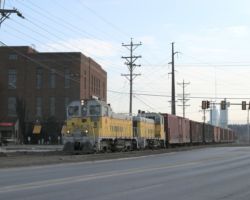
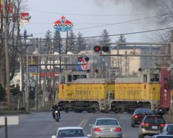
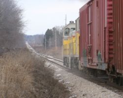
Iowa Interstate BICB-27 and BICB-29
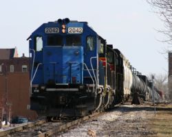
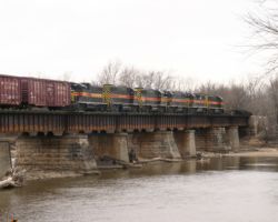
Assorted Miscellany From the Trip
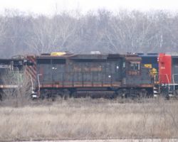
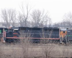
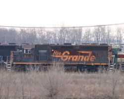

All photographs in this trip report were taken with a Canon EOS 10D with a Canon 28-105mm USM, a Canon 100-300mm USM, or a Canon 75-300mm f4-5.3 IS/USM.
This work is copyright 2024 by Nathan D. Holmes, but all text and images are licensed and reusable under a Creative Commons Attribution-NonCommercial-ShareAlike license. Basically you’re welcome to use any of this as long as it’s not for commercial purposes, you credit me as the source, and you share any derivative works under the same license. I’d encourage others to consider similar licenses for their works.
